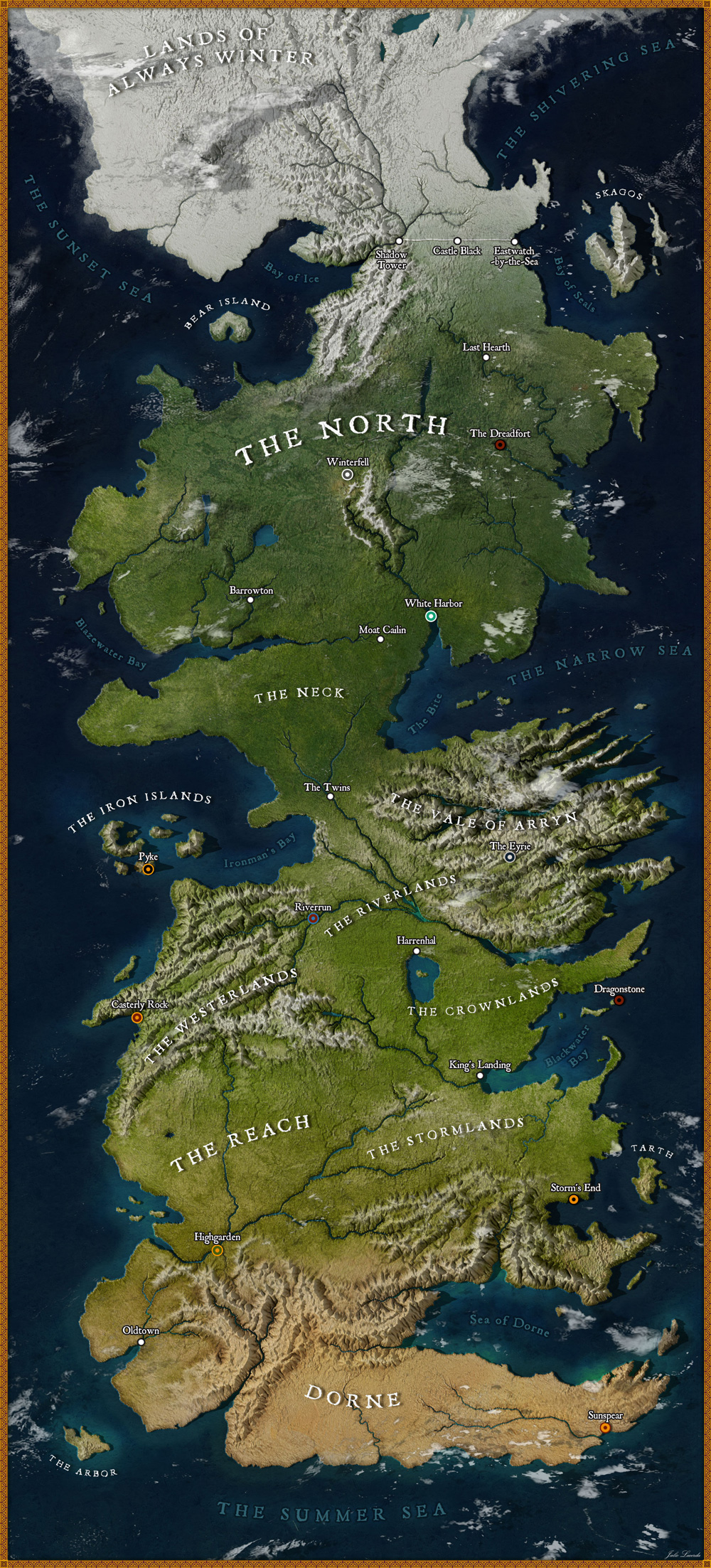
High-Res Map of Westeros from Game of Thrones
Cartography enthusiast
Julio Lacerda - Paleoarte created this detailed high-resolution map of Westeros from Game of Thrones and it looks like Ireland and the UK combined! Here's what they had to say about the process (can you can read more on
Bored Panda)...
"I�ve always loved geography and cartography, and for the past year, I�ve been creating some fantasy maps of my own. With season 8 airing, I felt inspired to try my hand at replicating this iconic map in a somewhat realistic way (as if it was seen from space), since most reconstructions of the maps in Game of Thrones go for either a simplified or traditional, vintage look. Fortunately, the map of Westeros is fairly well-documented. I cross-referenced several different sources, with special attention to the official The Lands of Ice and Fire maps. It took me around two days to create it; At first, I did the outline of the landmass, I then created a height map to represent the different altitudes and ran it through an erosion simulator, which gives the terrain this realistic look. Then I textured the image with the help of some aerial photographs from NASA and rendered it in a 3D software which interpreted the height map I created to replicate lights and shadows. The final step was to add all the graphics and text.�
[Click the image for a larger view...]
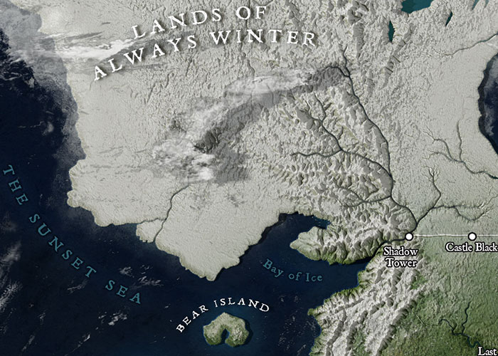
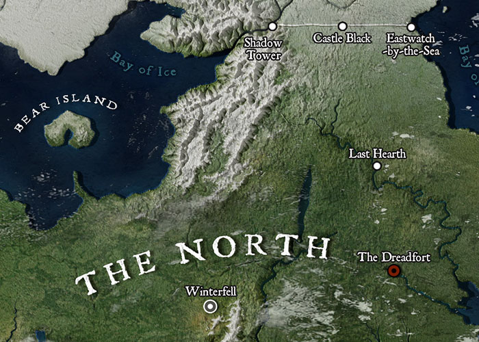
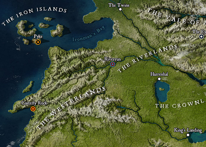
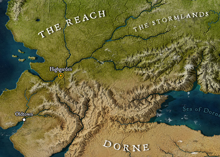
And here are some close ups:
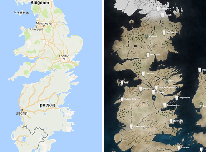
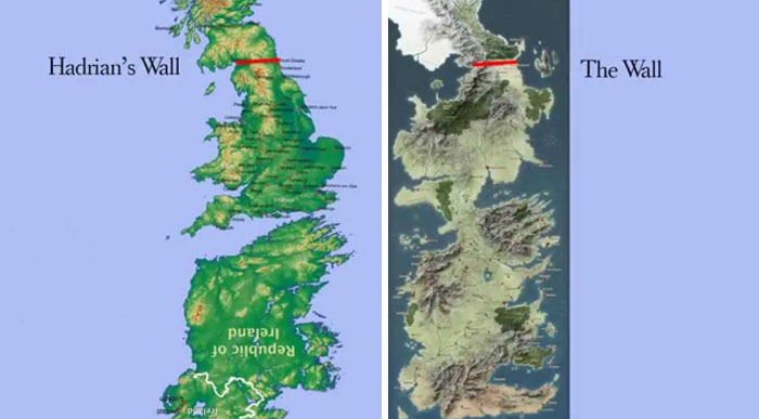
People noticed this map looks like Ireland and the UK combined:
Artist:
Julio Lacerda - Paleoarte
(via:
Bored Panda)
Follow us on:
May 23 2019